Tropical Depression Florita update; are face-to-face classes canceled?
On August 21, Sunday, a tropical depression was identified in the Philippines. It was later on named “Florita” making it the 6th tropical depression storm to enter the PAR. According to the Philippine Atmospheric, Geophysical and Astronomical Services Administration (PAGASA), it was heading west southwest.
The center of Florita was first located 540 kilometers east of Tuguegarao City, Cagayan. It gathered sustained winds of 55 kilometers per hour (kph) and gustiness of up to 70 kph. Moreover, Florita might get stronger and causes heavy rains in different parts of Luzon.
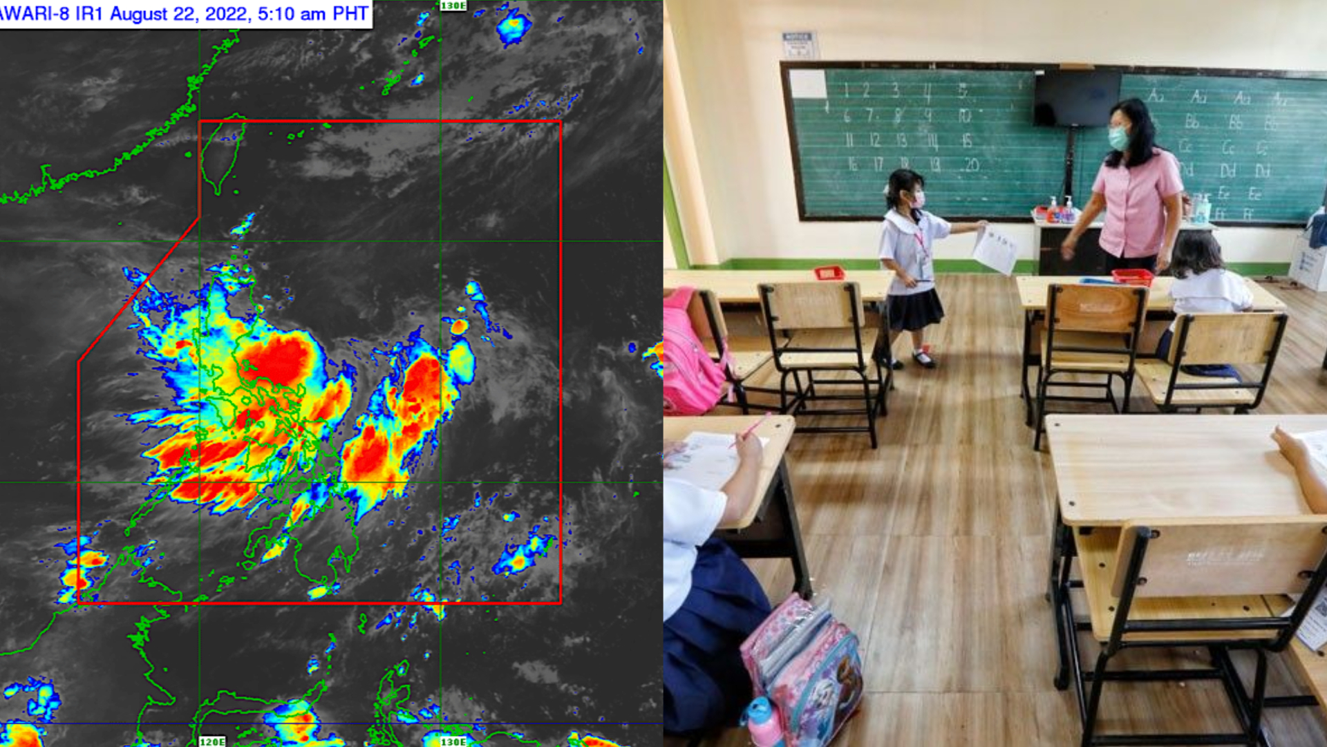
Moreover, the latest update about Florita is now a tropical storm. As of 11:00 a.m. today, it already has sustained winds of 75 kph near the center and gustiness up to 90 kph. Unfortunately, today is also the first day of face-to-face classes for many students in the country.
Are face-to-face classes suspended and what places are affected?
As the tropical storm Flortia intensifies, it would also be more dangerous. This is especially for the students to go to school on their first day of face-to-face classes. Moreover, some of the places affected by Flortia have already announced class suspensions.
The current places which declared class suspensions today as of 1:00 p.m. are:
- Cagayan – Elementary levels only
- Tuguegarao City – All levels, public and private
- Albay: Oas, Guinobatan, Daraga and Polangui, Albay – All levels, public and private
- Ilocos Norte: Solsona, San Nicolas, Paoay, Vintar, and Laoag – Elementary levels only
- Albay: Oas, Guinobatan, Daraga and Polangui, Albay – All levels, public and private
These suspensions are for the safety of all students, and employees. However, there are still places that haven’t announced any suspensions and to make it all levels instead.
LOOK: Because of the heavy rain being brought by #FloritaPH, flooding marked the opening of classes at the Libertad National High School in Abulug, Cagayan, prompting officials to suspend classes this afternoon. | 📷: Abraham Acosta via @AdrianINQ pic.twitter.com/E5VjlIgCvs
— Inquirer (@inquirerdotnet) August 22, 2022
More about the tropical storm Florita
These are the places under tropical storm signals as of 11:00 a.m. today.
Signal no. 2:
- Eastern Cagayan
- Eastern Isabela
- Extreme northern part of Aurora
- Northeastern part of Quirino
Signal no. 1:
- The remaining parts of Cagayan, Isabela, and Quirino
- Nueva Vizcaya
- Apayaw
- Abra
- Kalinga
- Mountain Province
- Ifugao
- Benguet
- La Union
- Ilocos Norte
- Ilocos Sur
- Northern parts of Aurora and Polillo Island
Landfall warning tomorrow
Florita is going to make landfall tomorrow either on the eastern coast of Cagayan or northern Isabela. Therefore, the suspension of class might also be extended tomorrow. So make sure to check out the latest updates in this hashtag #FloritaPH.
Stay safe, alert, and dry to everyone affected!
#FloritaPH was spotted east of Casiguran, Aurora.
The tropical storm is forecast to make landfall in the east coast of Cagayan or northern Isabela tomorrow afternoon. PAGASA says outside the Philippine Area of Responsibility, 'Florita' may intensify into a severe tropical storm. pic.twitter.com/pObs5f6kPi
— NewsWatch Plus PH (@newswatchplusph) August 22, 2022
You may also want to check out here at Spiel Times for the latest updates and content about various news in the latter days.
OTHER NEWS: Indiana State University students involved in a car accident; Were they drunk? + Survivors
If you have any questions, don’t hesitate to ask or let us know your thoughts about tropical storm Florita and the suspension of classes in the comments below. Until then, stay with us here at Spiel Times for more content.
SOURCES: Philippine News Agency, CNN Philippines, GMA News, Inquirer, ABS-CBN News, PAGASA
Related Articles
View All
Dell Gaming Laptops: The Smart Choice. Why the G-Series is the Wise Gamer’s Secret Weapon
We are living in a golden age of PC gaming. Games are more beautiful, more complex, and more immersive than...

Sims Rival InZOI Announces Official Release Date After Unexpected Delay
The highly anticipated life simulation game InZOI has officially announced its Early Access release date after an unexpected delay, much...

AMD Ryzen 7 9800X3D Sells Out as Scalpers Surge Prices to $999
The AMD Ryzen 7 9800X3D, the latest in AMD’s lineup of high-performance gaming CPUs, has sparked a frenzy among enthusiasts...